Documentary · Animation
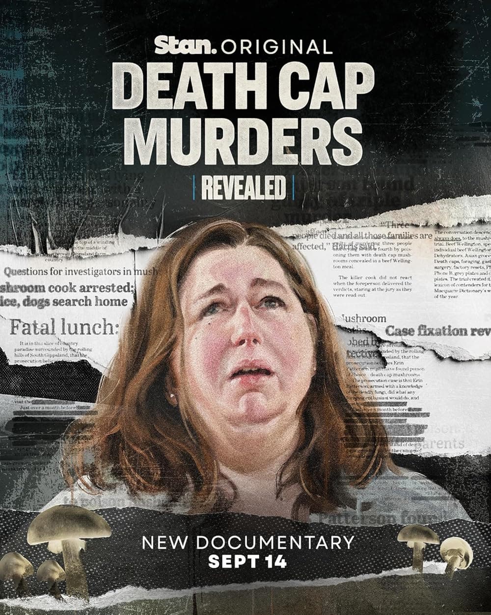
Revealed: Death Cap Murders
I contributed animation to Episode 2 of the three-part documentary series.
Series credits on IMDb ↗Geospatial specialist & researcher
Geospatial modelling · Radio propagation · Digital forensics
I’m a Senior Geospatial Specialist. My work examines radio coverage, spectrum use and possible movement between known locations. I completed my PhD at the University of Adelaide in 2025.
Selected media ↓Documentary contributions and reporting connected to my work.
Documentary · Animation
I contributed animation to Episode 2 of the three-part documentary series.
Series credits on IMDb ↗
Media coverage · Telecommunications
Coverage of telecommunications reconstruction connected to the Dear Rachelle investigation.
Read the coverage ↗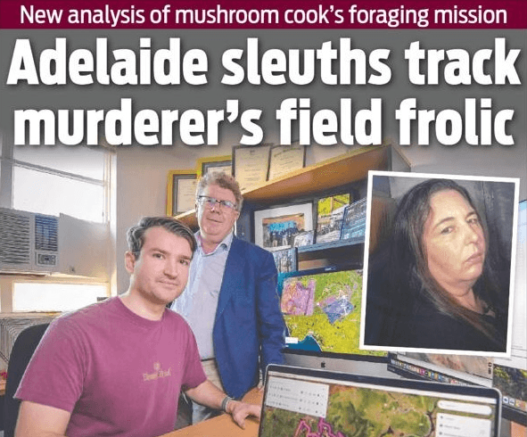
Media coverage · Spatial analysis
Reporting on radio modelling and possible movement in the Leongatha investigation.
Read the coverage ↗Interactive map · Australian radio data
Explore recorded radiocommunications sites and spectrum assignments across Australia, with filters for frequency and operator.
ACMA snapshot · 13 May 2026
My doctoral research considered how to allocate spectrum when propagation and interference are modelled under realistic conditions. The thesis is available below.
Reach Map uses known positions and times to bound possible movement.
Examples of my research simulations. These illustrate modelled propagation, reachability and interference; they are not field measurements.
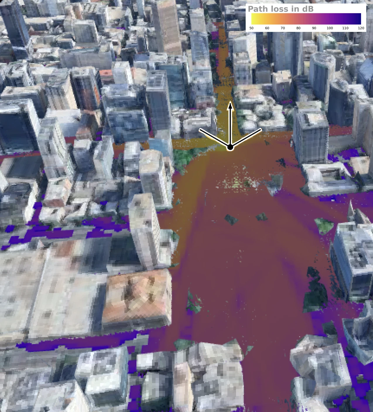
A 3D view of simulated coverage from a north-facing ground transmitter in Victoria Square. Buildings are modelled as solid concrete; open spaces and reflected paths shape the coverage.
3D model derived from Google 3D Tiles; propagation simulated with Sionna RT.
From my thesis ↗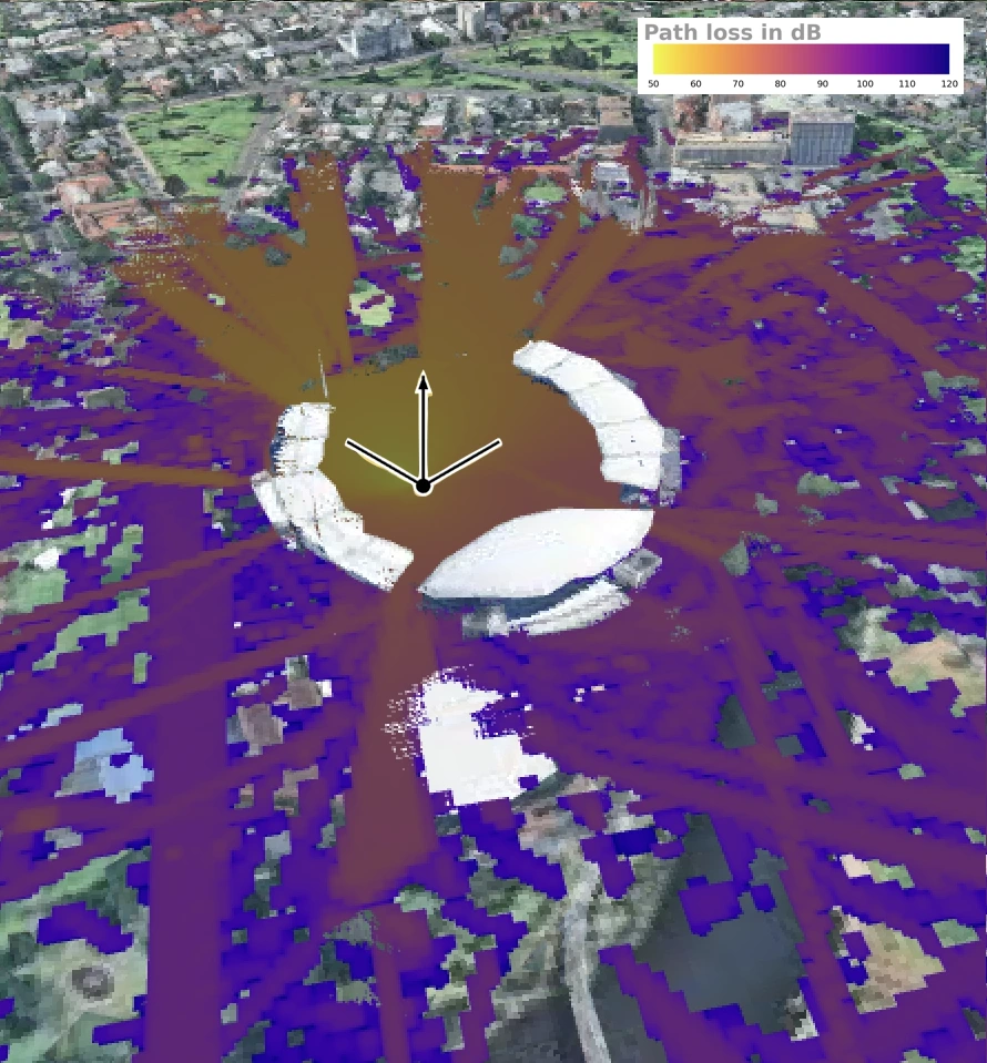
A 3D view of simulated coverage from a north-facing ground transmitter at Adelaide Oval. Reflections and gaps in the stadium structure allow paths into areas without direct line of sight.
3D model derived from Google 3D Tiles; propagation simulated with Sionna RT.
From my thesis ↗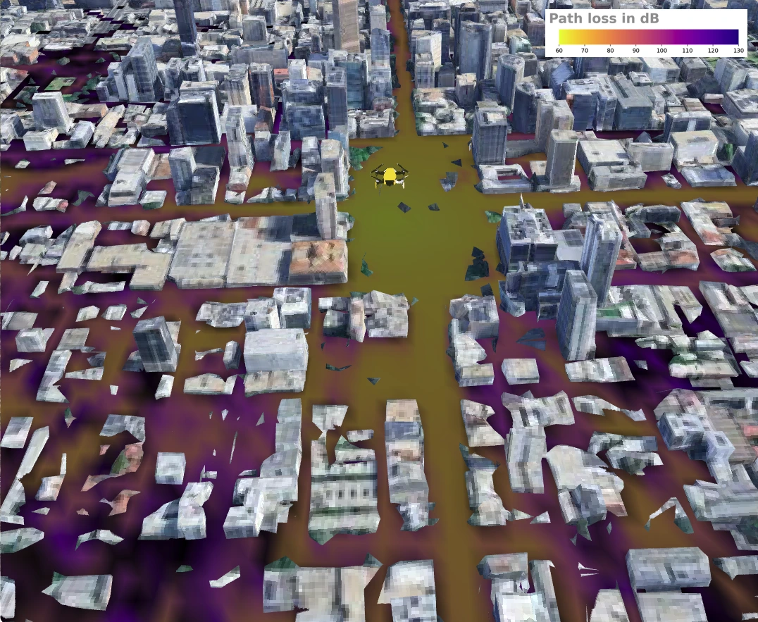
Simulated ground coverage from one omnidirectional drone antenna above Adelaide CBD. The yellow drone marks the transmitter location.
3D model derived from Google 3D Tiles; propagation simulated with Sionna RT.
From my thesis ↗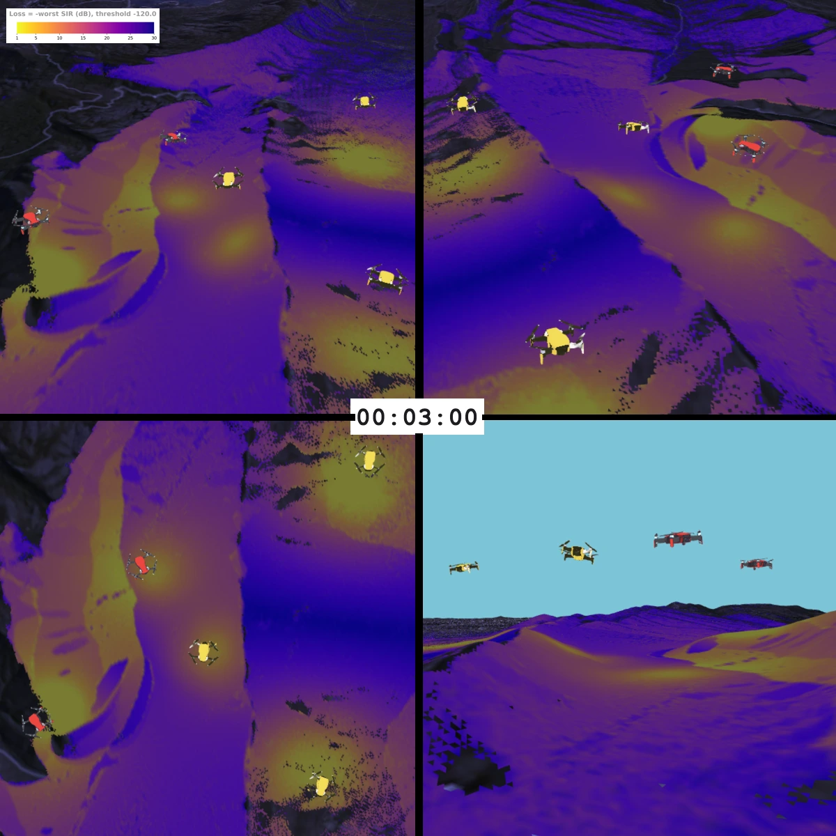
Four views of the same simulated instant at 3 minutes near Halls Gap. Colours show the mutual worst signal-to-interference ratio; drone icons are enlarged for visibility.
Terrain derived from SRTM 30m; propagation simulated with Sionna RT.
From my thesis ↗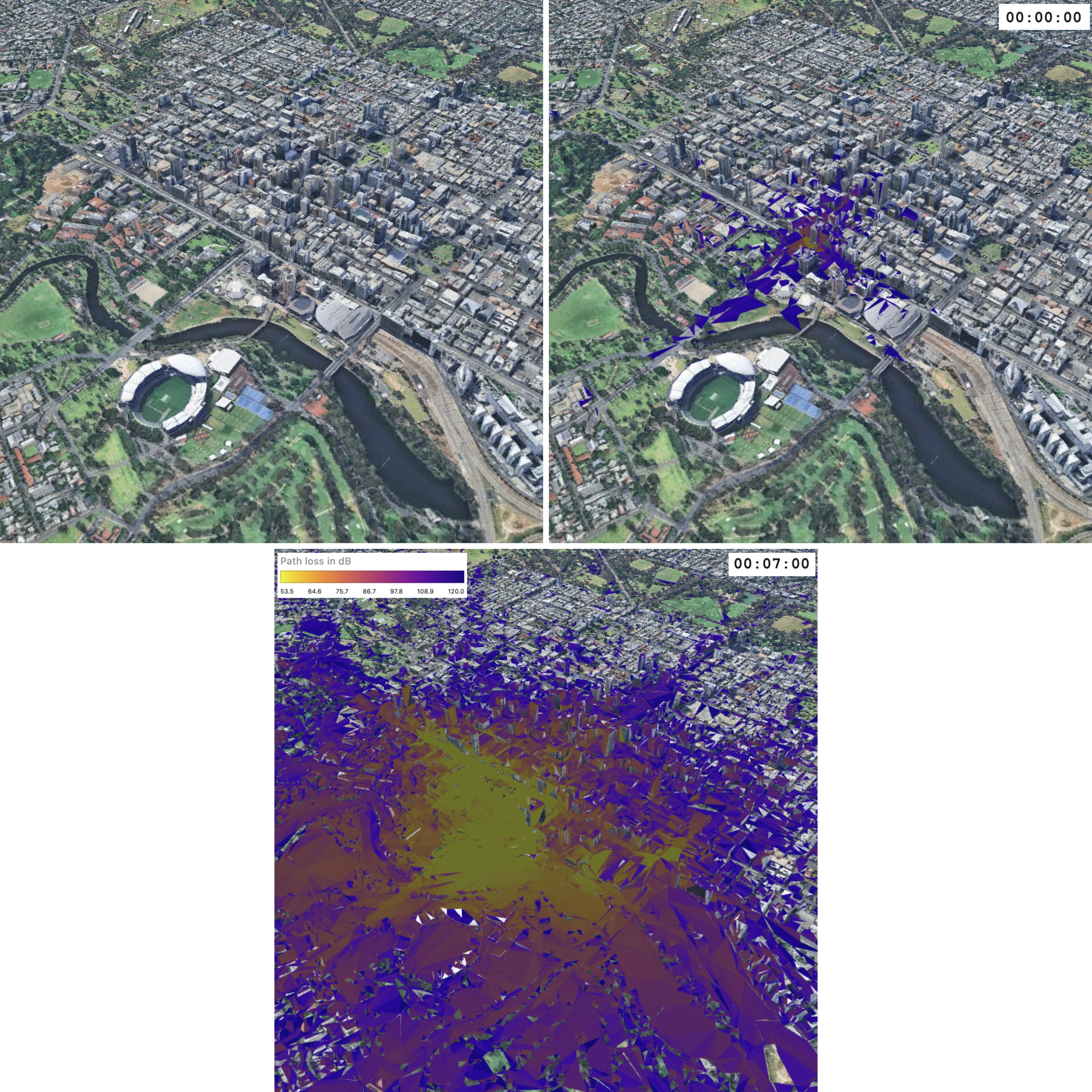
Adelaide CBD: top left shows the scene before the initial time, top right at 00:00:00, and the lower view at 00:07:00. Possible walking reach is combined with simulated propagation, rather than an exact recovered path.
3D model derived from Google 3D Tiles; reachability uses Valhalla; propagation simulated with Sionna RT.
From my thesis ↗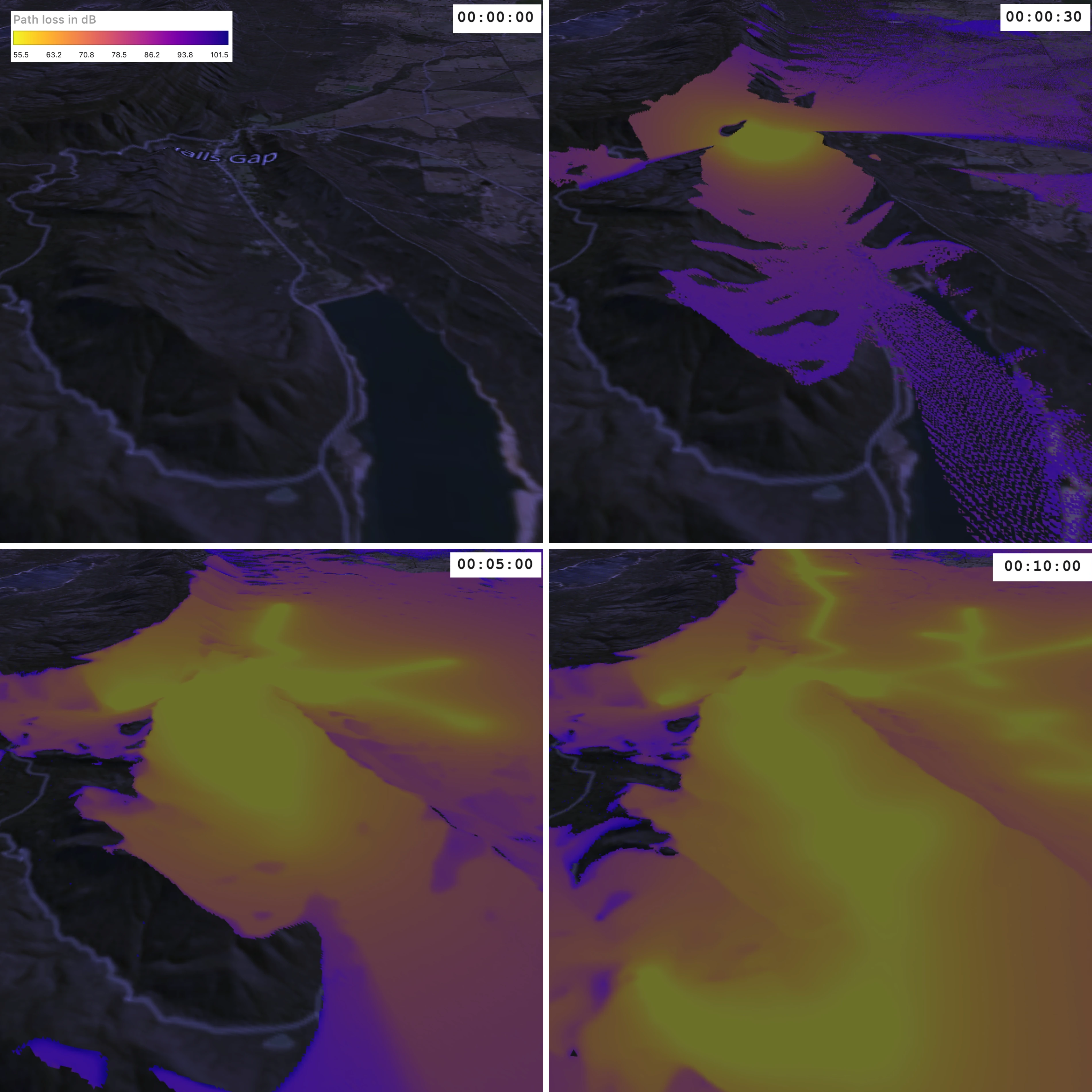
Possible driving reach combined with simulated radio propagation. Panels retain their original order: 00:00:00, 00:00:30, 00:05:00 and 00:10:00, read left to right across each row.
Terrain derived from SRTM 30m; reachability uses Valhalla; propagation simulated with Sionna RT.
From my thesis ↗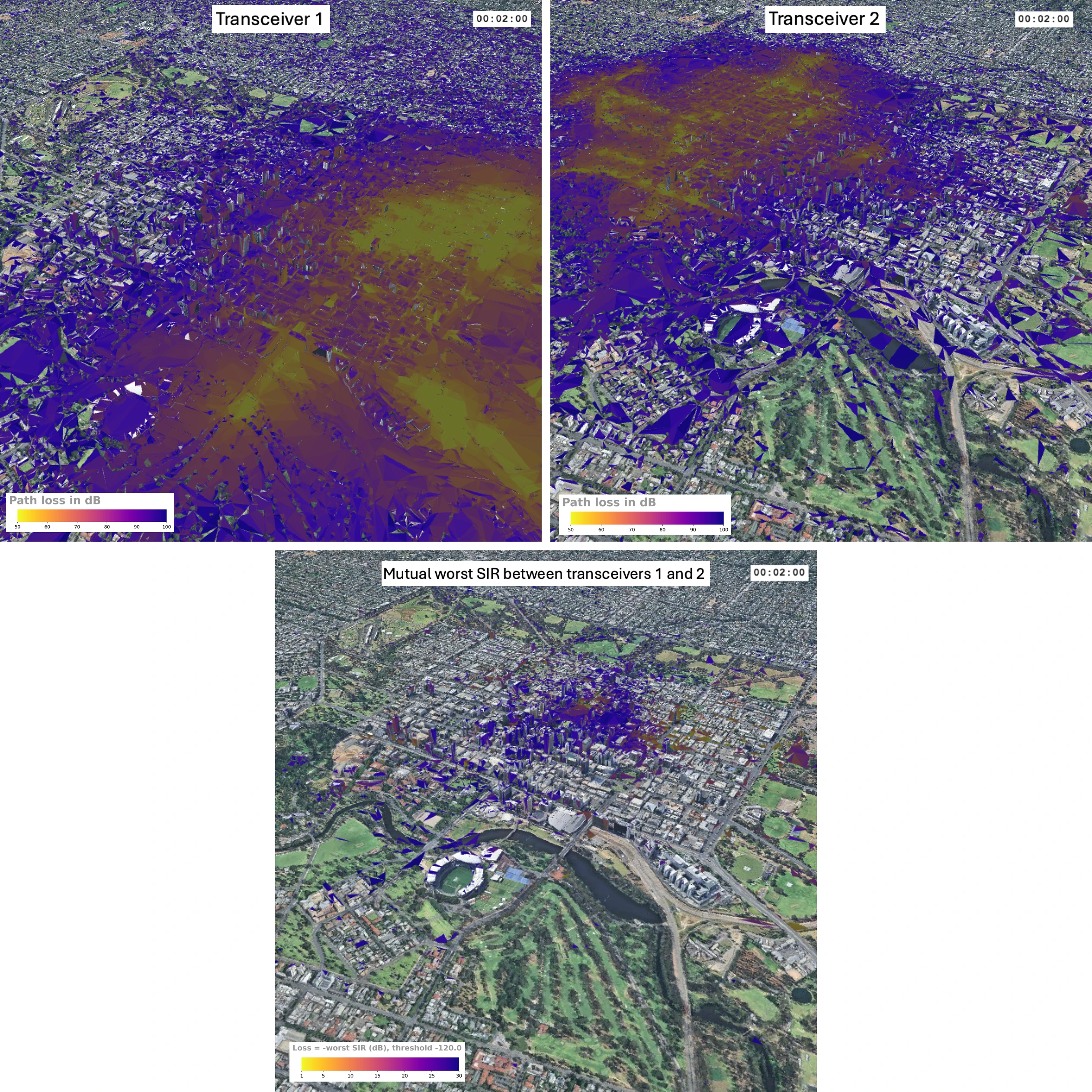
At 2 minutes of possible driving, the upper views show simulated path loss for each transceiver. The lower view shows their signal-to-interference ratio.
3D model derived from Google 3D Tiles; propagation simulated with Sionna RT.
From my thesis ↗My PhD examined spectrum allocation under realistic conditions, using radio propagation models to account for interference and the surrounding environment.
An algorithm for mapping where movement was possible between known positions and times. Presented at DFRWS APAC in Brisbane, 2024. It describes possible movement, rather than recovering an exact path.
A white paper on using terrain elevation data to model line-of-sight radio propagation.